
Tales from the Trails of Mt. San Gorgonio
Tales from the Trails of Mt. San Gorgonio
Known colloquially as “Old Greyback,” the highest peak in Southern California regularly attracts a number of avid hikers to its trails, including those who spend hours slogging their way to the summit, as I did with a friend of mine on May 18.
My friend, Frank Henry-Reyes, a high school history teacher in Carlsbad, California, picked me up at around 2:30 a.m. that morning. Given my night owl tendencies, I stayed up that evening, opting not to try to catch shuteye when I knew sleep would unlikely be forthcoming. Given the sensitivity of my stomach when it comes to even mild feats of exertion, I also didn’t eat much.
Needless to say, the lack of sleep and sub-optimal nutrition contributed to the hellaciousness of our 12-hour hike to the summit of San Gorgonio Mountain, which stands more than 11,000 feet high amid the San Bernardino Mountains. Mt. San Gorgonio boasts the longest line of sight on record in the contiguous US.
Frank parked his vehicle in a lot inside the San Bernardino National Forest near the South Fork Trailhead around 3:30 a.m.
I placed the Ultimate Direction SJ Ultra Vest 3.0 over my chest. Scott Jurek, the ultrarunning legend who won the hyper-competitive Western States 100-mile Endurance Run seven consecutive times, helped popularize the signature running vest. It was designed with easy-access hydration in mind, given the anterior, over-the-chest placement of the pockets holding the “body bottles,” water bottles made of a moldable, pouch-like plastic that kind of conforms to one’s torso. They’re supposed to bounce and bother you less than hard plastic bottles when one moves at a quick clip.
Frank went with a hiking pack. I can’t stand something that heavy on my back for any extended period of time.
The hike, we had heard, was supposed to take eight to 10 hours. But who are these speed racers completing this so fast? I’m curious as to the identity of these speed demons who can hoof it up and down the tallest peak south of the Sierra in 10 hours or less. We weren’t even close to finishing within that amount of time. Not even close.
I wore the Merrell Bare Access XTR shoes during the hike, given my preference for minimalist footwear that mimics the natural movements of the feet while running (and walking/hiking). I think the shoes allow for greater proprioception and responsiveness to challenging, changing terrain.
Frank chose footwear with greater cushioning and protection.
“Two words: Hiking boots,” he said afterward when I asked him if he had advice for any would-be Old Greyback guests. “If I didn’t have hiking boots I don’t know how I would’ve handled all those rocks.”
Indeed, the trails up and down Gorgonio feature an abundance of rocks. “Lots of rocks, as we can both attest to,” Frank said. “Too many rocks.” Indeed.
Moving over rocks for multiple hours as we made our way up the mountain messed up my friend’s feet.
Mine didn’t feel great either, especially since I’ve been struggling with heel and arch pain in my left foot this spring.
In fact, my left foot probably wouldn’t have been in shape for the hike without help. Shout out to Marissa Rodriguez, a friend of mine and a skilled massage therapist who runs the Serene Senses studio in Riverside, California, and offers cryotherapy with a fancy TShock cryo machine. The modality seriously minimized the pain emanating from my plantar fascia, the band of tissue connecting the heel to the forefoot. I splurged and scheduled several cryo appointments with Marissa prior to the hike, and I have to credit her and the therapy with reducing the inflammation enough to get me over the trails with no more foot pain than my friend Frank suffered, as far as I could tell.
“I’m surprised I didn’t roll my ankle,” Frank also said after we (finally) finished.
I personally had a couple close calls and had to catch myself from slipping and falling several times as we made our way up, and then later back down, the exceedingly tall mountain. Again, though, wearing the minimalist shoes, with the footwear’s zero drop design and its near-the-trail sensitivity, I think I stood a better chance of keeping my ankles injury-free than I otherwise would have if I wore conventional hiking shoes or maybe even boots. As an aside, barefoot-simulating hiking footwear does exist, it’s worth noting. I’ve just yet to try it.
Having noted my preference for minimalist, barefoot-behaving shoes for endurance events, I should also add that after severely spraining my right ankle playing pick-up basketball as a freshman in high school — likely tearing ligaments in the process and doing some other damage, as small calcific densities showed up in the surrounding tissue during an exam a few years later — I now only shoot hoops in high-tops. In addition to the cushion high-top sneakers provide, which is sorely-needed given the sprinting and jumping involved in basketball, the sneakers also seem to protect my ankles when I move laterally in what I presume is a slow, probably slightly pathetic-looking way, and when I make mostly unimpressive cuts on the court, blowing by nobody. But I digress — or not, as this partial tangent mirrors the rumination I engaged in over the course of those 12 hours on the mountain, my mind wandering, vacillating in relation to the varying difficulty of the trail.
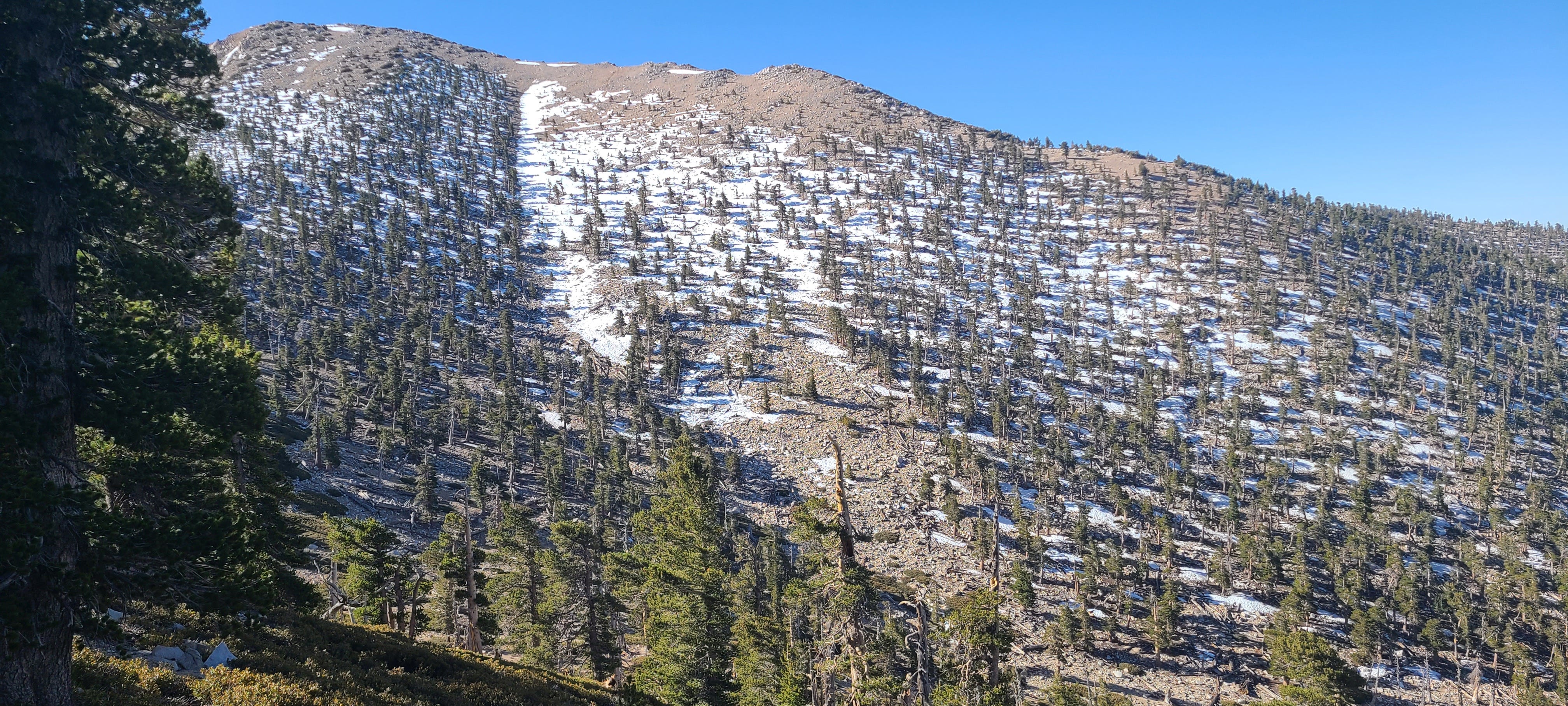
Frank and I passed through areas with pine trees during the hike, but we also traversed big barren areas of dead pines.
“So that made it a little less scenic,” he said.
My friend attributed the latter to the Lake Fire, which burned about a third of the San Gorgonio Wilderness, approximately 18,000 acres in the San Bernardino National Forest, in 2015.
“Not much for flowers even though it’s spring,” he added.
I was freezing early on, and yet I’m still thankful I, at minimum, thought to wear my AK Press hooded sweatshirt instead of just a moisture-wicking t-shirt. It was chilly enough to warrant the hoodie at the beginning and for almost, maybe not quite, half the hike. The temperature remained reasonable enough I wore it later during a good chunk of the descent as well.
We passed “Poopout Hill,” so named, rumor has it, because of how many hikers are inclined to poop out and head back down the mountain once they reach that point.
Somewhere in wooded area saw a solitary log cabin, a not-uncommon feature along many major mountain trails, I’ve discovered.

The increase in elevation wasn’t too bad, up until around 10,000 feet.
“It was actually kind of a leisurely ascent,” my friend recounted afterward. “There [weren’t] a whole lot of long and steep areas.”
At a certain altitude, that changed. The elevation exacerbated the difficulty of the steeper stretches, and it started making me increasingly nauseous the further we went.
“At about seven miles we’re going to get to 10,500 feet,” my friend told me shortly before we had to go slightly rogue and trek at a steep incline off-trail momentarily in order to get to where we needed to go.
After we got to that altitude, we went left, onto the San Bernardino Peak Divide Trail toward the top of the mountain. Onward and upward, as they say.
Heading upward proved harder than anticipated. It’s around then when I began to feel not-so-great, hindered by gastrointestinal distress, a gross feeling like I needed to burp (or vomit) something up, and labored breathing. I’ve struggled with iron-deficiency anemia in the past, and I imagine I lacked the ample amount of red blood cells needed to capably transport oxygen to my muscles and tissues during feats of exertion, predisposing me to altitude-induced nausea during the hike.
“You see that sign in the tree?” Frank asked when we approached a marker announcing Dry Lake View camp.
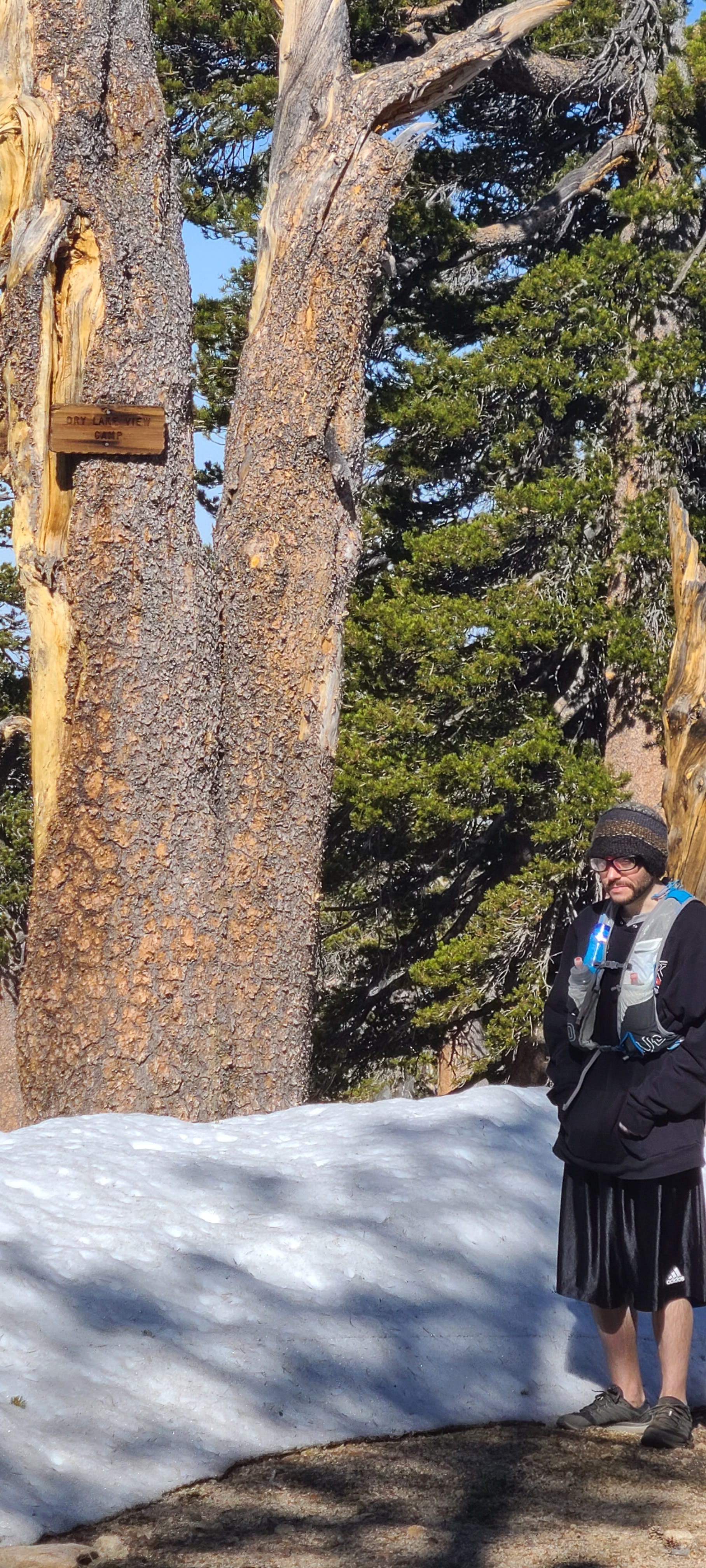
Somewhere around there we encountered a significant amount of snow.
“We can’t leave here without me throwing one snowball,” Frank said.
Whereas I grew up in the Midwest and endured my fair share of brutal winters shaped by immense cold, snow, ice and sleet, Frank came of age in Southern California. Seeing snow is like spotting a unicorn for him.
“I feel we got very lucky because the snow wasn’t too much of a nuisance,” Frank, who didn’t anticipate so much snow, said following the end of our journey. “It was packed.”
He’s right.
We did, however, have to watch ourselves as we made our way over a narrow part of the trail packed with snow, either all over it in stretches or to the side. Frank affectionately called it “death ridge,” a deserved moniker considering the precarious foot placement available along the snow-covered ridge.
My feet got wet hiking over deeper segments of snow. That was annoying but not a big deal given the degree to which it had warmed up outside compared to the chilly night air we faced when we started out. The dampness inside my shoes dried up soon enough.
Once we made some progress along the San Bernardino Peak Divide Trail in the direction of Old Greyback’s peak, Frank took more photos with his phone.

“You have a certain look in your photos,” he told me on the trail, adding: “Again, I’m going to be Frank. [And] you look sickly.”
I don’t doubt I did then.
“Well right now I kind of feel sickly,” I said, “so I think that explains that one.”
Frank felt compelled to further emphasize my sickly-looking appearance in the pictures.
“Ghoulish,” he stressed. Ouch. But at the time, fighting my sleep-deprived urge to lie down on some rock and remain in a relaxed, unconscious state for hours, as I continued to lift one foot in front of the other despite the GI discomfort and queasiness I felt, I was confident Frank’s description was spot-on.
“Whenever we go up these little inclines, I can immediately feel the lactic acid in my thighs, like immediately,” he said as we inched up San Gorgonio, getting closer to the summit.
I could relate, but it was the stomach and respiratory discomfort, along with an unshakable desire to shut my eyes and immediately go to sleep for an indefinite stretch of time that made Mt. San Gorgonio such a test of fortitude for me.
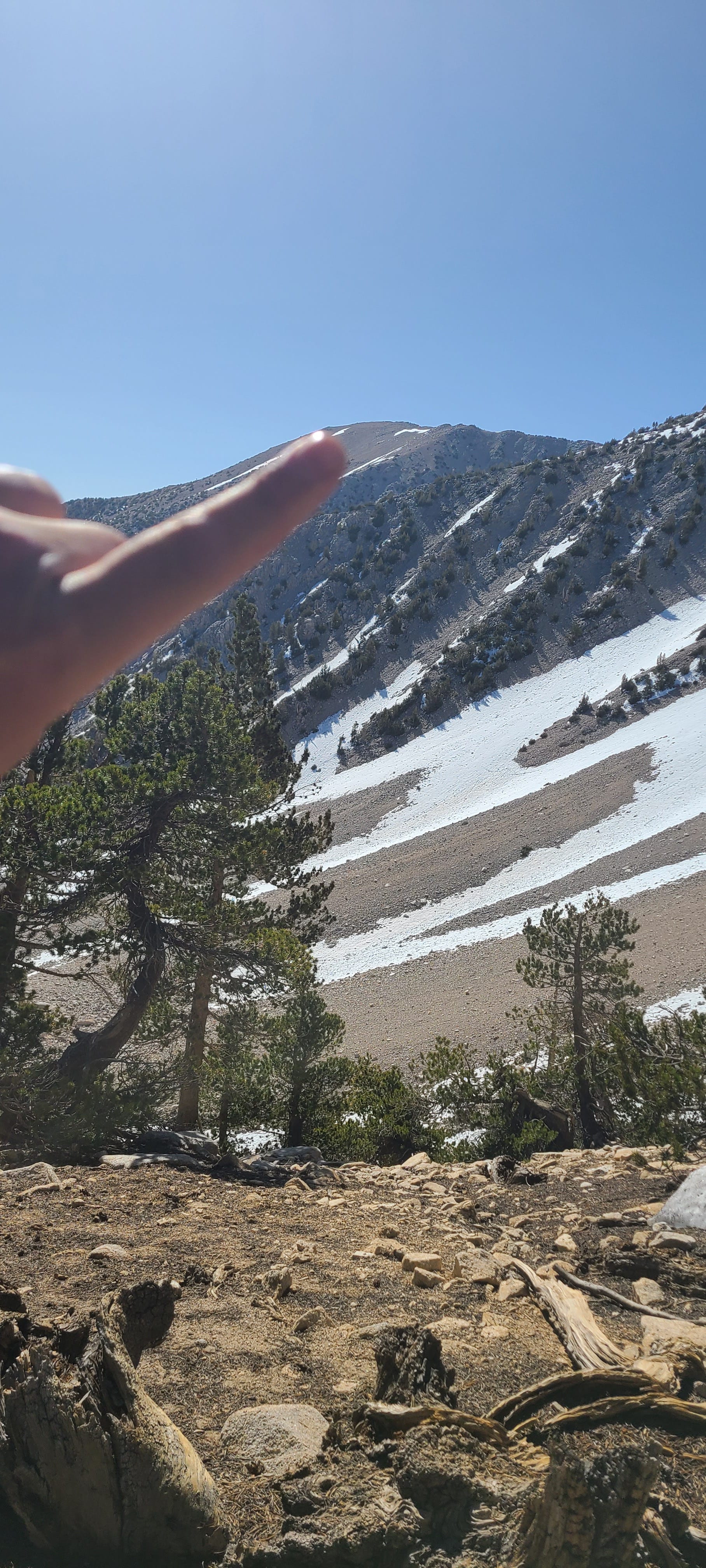
“Some of the views were incredible, though,” Frank reminded me, upon us finishing. “Just before we hit the top, there were these places that the guy I read about online called ‘the windows’, and you’d go along and you couldn’t see the view on your left because the hillside was right there. But then the hillside would open up, and then close up again real quick, and you could see these incredible views.”

About a mile from the peak, I stepped to the side of the trail, put my hands on my knees and tried to relieve my nausea by hurling up whatever I could. I couldn’t do that very well because there was next-to-nothing solid in my stomach, so I spit and dry heaved. Several times. The nauseated and exhausted feelings fueled the discomfort that spurred the dry heaving, that horrible vomit-free hacking up of not much save for some saliva and stomach acid. After a few heaves, I spit, stood up, and continued up the trail with Frank.
We didn’t make it too far before I dry heaved again. This time it happened as two young, athletic women passed us on the trail, a few hundred meters from the top.
One rhetorically asked if it was the altitude when she saw my futile efforts to throw up. I mumbled something back in the affirmative, looking like a disgusting, miserable mess, I imagine. Under normal circumstances that might’ve made me at least a little self-conscious, conversing with a vibrant young woman in a disconcertingly wretched state. In this case, I couldn’t have cared less and just craved some relief from the heavy breathing and heave-provoking GI disturbance.
Frank and I hiked a bit more, at an unimpressive pace, and finally reached the peak around 11 or 11:30 a.m., a full 10 miles up two major trails traversing the mountain until we approached the highest possible plateau.
Frank snapped a photo of us at the summit.
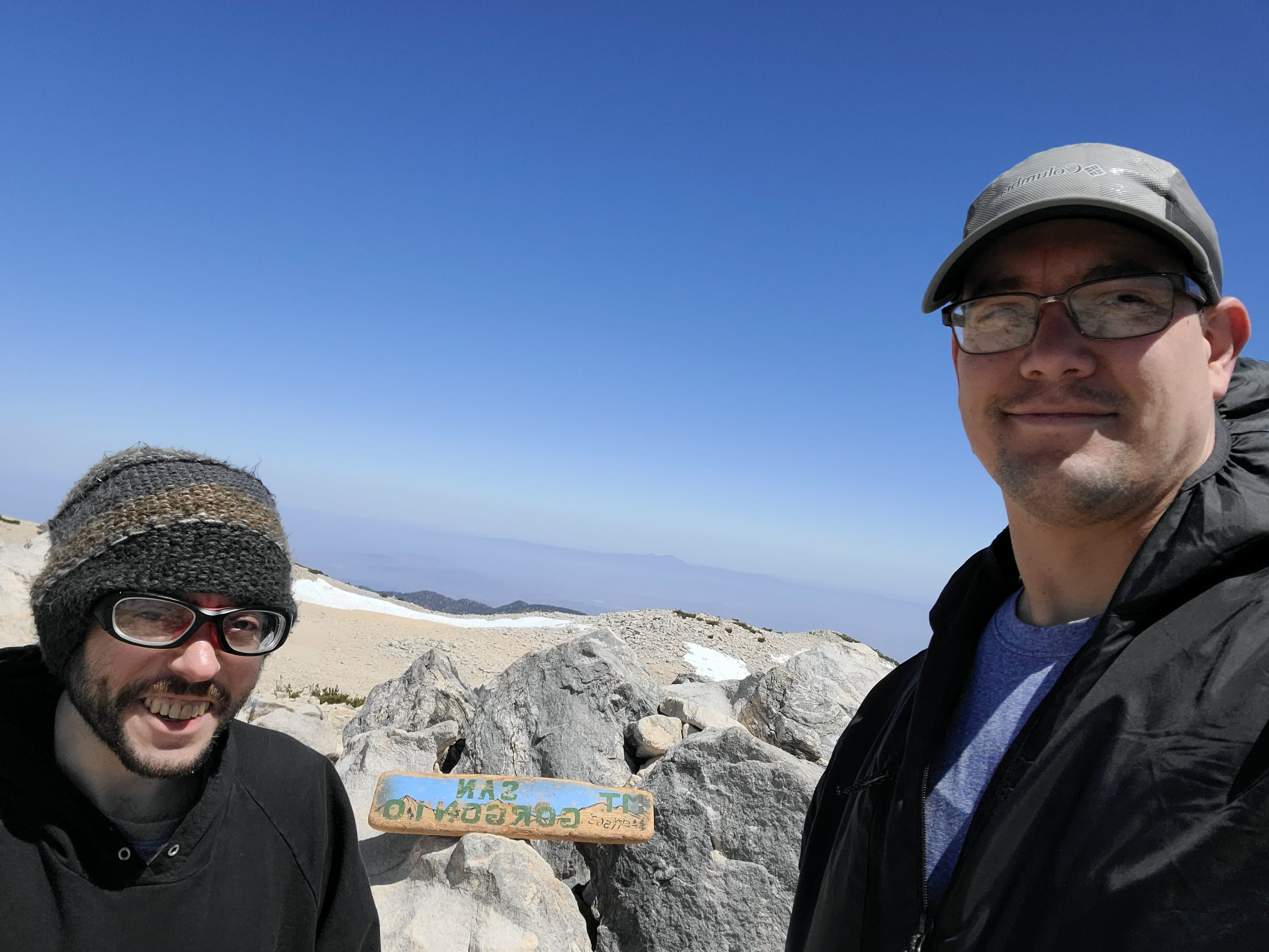
Hikers will find a rectangular-shaped block of wood with “Mt. San Gorgonio” painted on one side, along with “11,503,’” denoting the elevation in the lower-left corner of the sign sitting atop the mountain, as is kind of the custom to find at the summits of the major peaks in the region.
Frank took a smartphone photo of me holding the bigger block of wood.

He also got a picture of me holding the smaller, broken sign with the last few letters of the mountain’s name (“ONIO”) and that number representing the height the hikers summited faintly painted on a side of it. (To state the obvious, the base of the mountain is not at sea level, so nobody who hits the San Gorgonio trails hikes the full 11,000-plus feet. The approximately 10 miles up and 10 miles back down starting at elevation in the forest is plenty, I assure you.)

Our fit friends who witnessed me dry heave made it to the summit too. Frank took a picture of them holding the bigger slab of celebratory wood upon request.
The women told us they had been running the trails up the mountain. I’d been wondering how many trail runners take on Mt. San Gorgonio. Not many, I assumed, given how incessantly rocky it is, but that evidently didn’t deter these stunning young women, equipped as they were with running poles and admirable enthusiasm for the outdoors, for life.
Not long after Frank took the photos, the two women took off, ready to rush the descent at a decent clip.
Frank and I rested for a few minutes and then headed back down.
“I’m totally cool not conversing for a while, by the way,” I told my friend soon after we started down the trail, having decided to just keep going, somehow, and to grind it out for the next few hours as best I could. “It feels like putting myself on auto-pilot allows me to be most functional, and that doesn’t allow for talking.”
Frank didn’t object. “I like it,” he said, leading the way at that point, as he did for most of the descent.
Without speaking hardly at all for long stretches, he and I hiked for several more hours.
I recall how climbing over large tree limbs that had fallen onto the trail took a lot out of me on the descent, as did all the rocks. Endless rocks, everywhere. Forward motion over them at an incline and then a decline on the trails gave my joints a bit of an uncomfortable wrenching and pounding. Thankfully, there wasn’t any serious residual pain post-hike.
My friend and I kept thinking we were closer to the trail head than we in fact were and wished to be, which messed with our minds. That in turn contributed to the strenuousness of the second half of the hike.
An hour or two from the bottom I couldn’t help but notice both of us grunting, moaning and making other animalistic mouth noises. We sounded terrible, and perhaps terribly hilarious, making primal utterances tantamount to transduced expressions of the prolonged bodily discomfort we were experiencing.
With all the moans and grunts, we sounded like the stars of a really bad pornographic movie, as I jokingly informed Frank at the time. The thought of a porno featuring the sounds of bedraggled, fatigued hikers set amid the San Bernardino Mountains amused me.
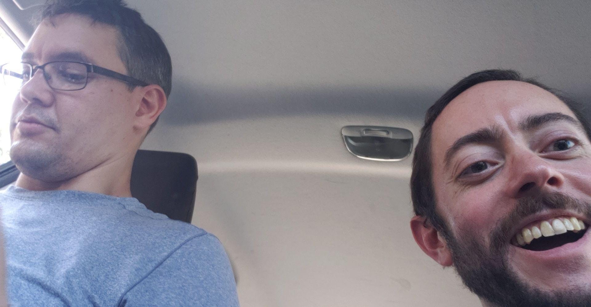
Eventually we made it out of the wilderness and back to the parking lot. We stumbled into his vehicle. I was so relieved to be done, to not have to propel my feet forward over unforgiving rocky ground anymore.
“Very strenuous,” Frank surmised.
I think he was hurting more than me at that point. He mentioned how awful his feet felt.
Speaking frankly (pardon the pun), full of exhaustion following the 12-hour trek, my friend, an experienced hiker in his own right, offered advice for those wanting to tackle the trails to the top of Mt. San Gorgonio.
“I would suggest that one camp when they’re there instead of doing the whole thing like we did, like idiots,” Frank said. He also recommends hikers get an early start.
Given the propensity for snow to accumulate the further up the mountain one goes during certain times of the year — to wit, the South Fork Trailhead sign reads, “SAND TO SNOW,” for a reason — Frank shared hiking advice attentive to the seasonal fluctuations.
“Check in with the ranger and see what the conditions have been like,” he entreated trail trekking enthusiasts. “Make sure you get a permit, if you’re going to be out in the wilderness.”
A mildly pleasant sense of accomplishment, a feeling of having persevered through a grueling challenge despite a part of me desperately wanting to call it quits during the hike, and the modicum of satisfaction I embraced, having completed this difficult task what we set out to do, competed with my feelings of woeful weariness while I rode passenger side on the drive back.
“The trails were nice,” Frank readily acknowledged after the hike, his post-trail suffering and soreness aside. “They were definitely overgrown in some areas. If I wasn’t so tired I’d say that it was a beautiful hike.”

All credit to Frank Henry-Reyes for the above photos, except for the one I took after the hike when we were seated, recovering inside his vehicle.